
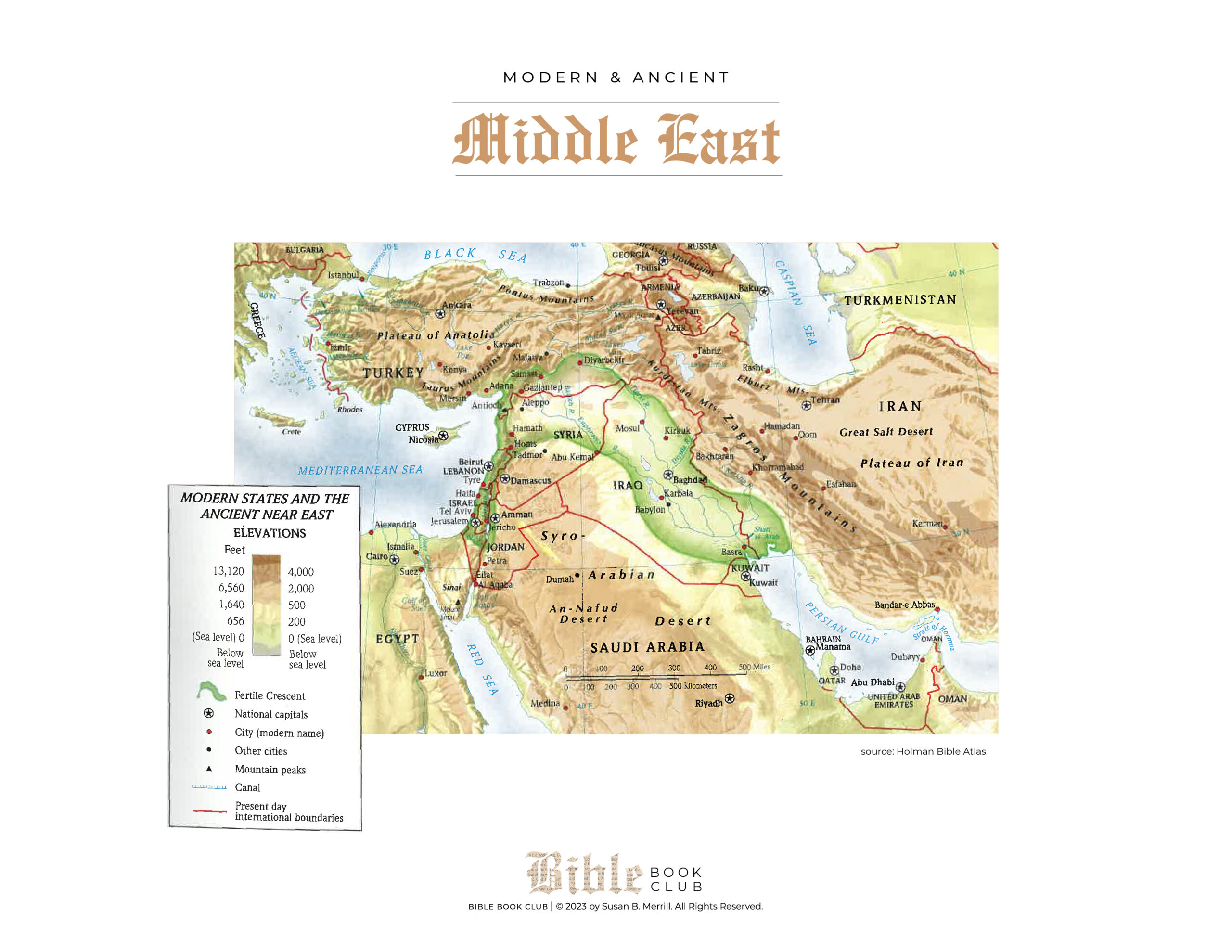
Ancient Middle East Map
This map, by Holman Bible Atlas, shows a ancient Middle East map. It highlights the territory where the fertile crescent is located with our current country outlines. The Map shows the countries of Saudi Arabia, Iran, Iraq, Turkey, and even Egypt. I love how it shows present-day Middle East and the overlay of the fertile crescent between Iraq and Iran.
I love this map as it highlights various territories in Bible clearly. It’s fascinating to me to see the various canals, such as the Persian Gulf, and the the different territorial elevations in relation to the fertile crescent. As we know from the Bible, the fertile crescent was lush and fruitful. It makes sense that is surrounded by water and has lower elevation.
What do you find fascinating about the ancient map? What do you find intriguing about the map? I love seeing where Jerusalem and Jordan are (Saudi Arabia) in relation to most of the fertile crescent (Iraq/Iran). Do you like having the visual? There will be many more maps added over time in the show notes for Biblical event we have yet to study together. Don’t miss out–keep checking the show notes page for updates.
